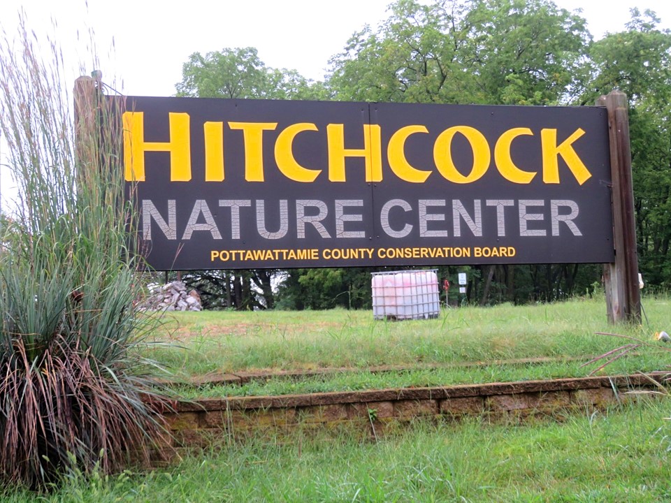
Where in Iowa: Loess Hills – Hitchcock Nature Center
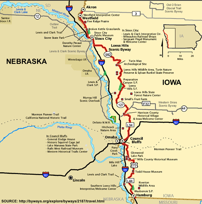
So what are the Loess (pronounced “luss”) Hills? They are certainly not your ordinary hills. They were formed by deposits of very fine, windblown soil at the end of the last ice age! The only other place you can find landmarks such as these are China.
Of the 200 extensive miles of Loess Hills in Iowa, the Hitchcock Nature Center is located in the middle of that line. I chose Hitchcock Nature Center as my first experience viewing the Loess Hills because it was the shortest drive and the park came highly recommended for its trails and minimal amount of tourists. (For directions, scroll to the end of the blog)
The Loess Hills extend for 200 miles. I barely scratched the surface exploring them today.
The park has 12 miles of hiking trails to suit everyone’s tastes and fitness levels. Ridge/ravine as well as open prairie trails provide challenges and experiences of all ages and abilities. The Loess Hill rise to 300 feet in some areas. It’s a fantastic place to disconnect and experience beauty or get a great workout!
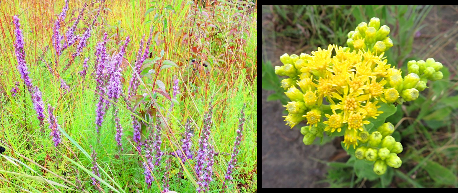
The 1,268 acre preserve contains some of the last remaining swaths of prairie in the state. It’s also home to 380 documented species of plants, 243 species of birds, and a variety of wildlife as well as butterflies, dragonflies, moths, beetles, and spiders.
The park is home to 380 documented species of plants – even in Sept, some flowers were still in full bloom
The Old Lincoln Highway that leads down to the park is part of the scenic 220-mile America’s Byway. The scenic byway allows ample opportunities for exploration of the charming small towns that line the route as well as a picturesque view of the countryside.
As you enter the park, you will see a small pay station/drop bin. You are asked to pay $5 per carload. This is a nominal fee for upkeep to the park and totally worth it! The fee is paid on an honor system so have exact change ready.
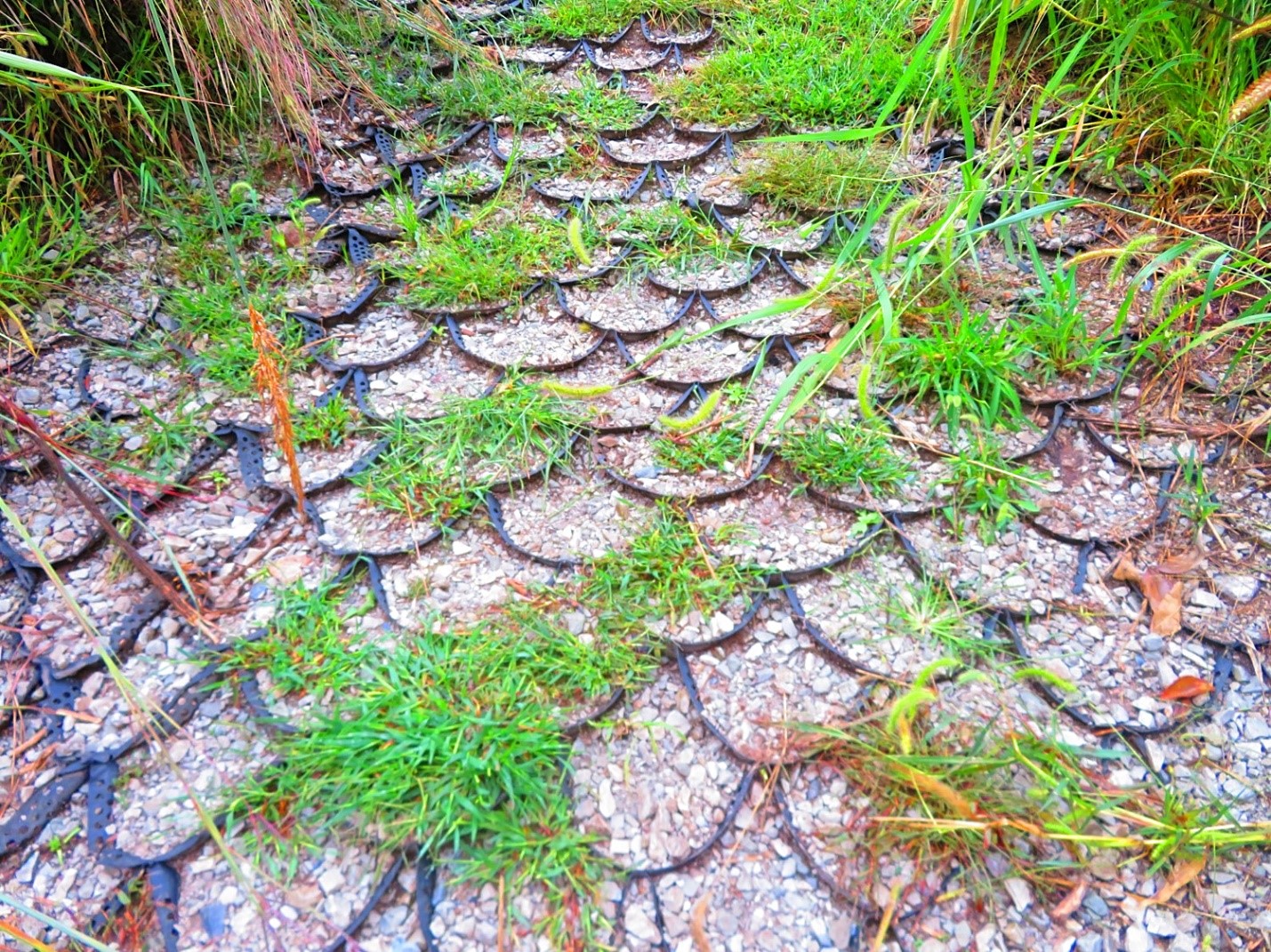
Some parts of the trail are steep and these traction grids are helpful to secure your footing
With COVID protocols still in place, the Nature Center Lodge and gift shop have adjusted hours which you can find online: Hitchcock Nature Center
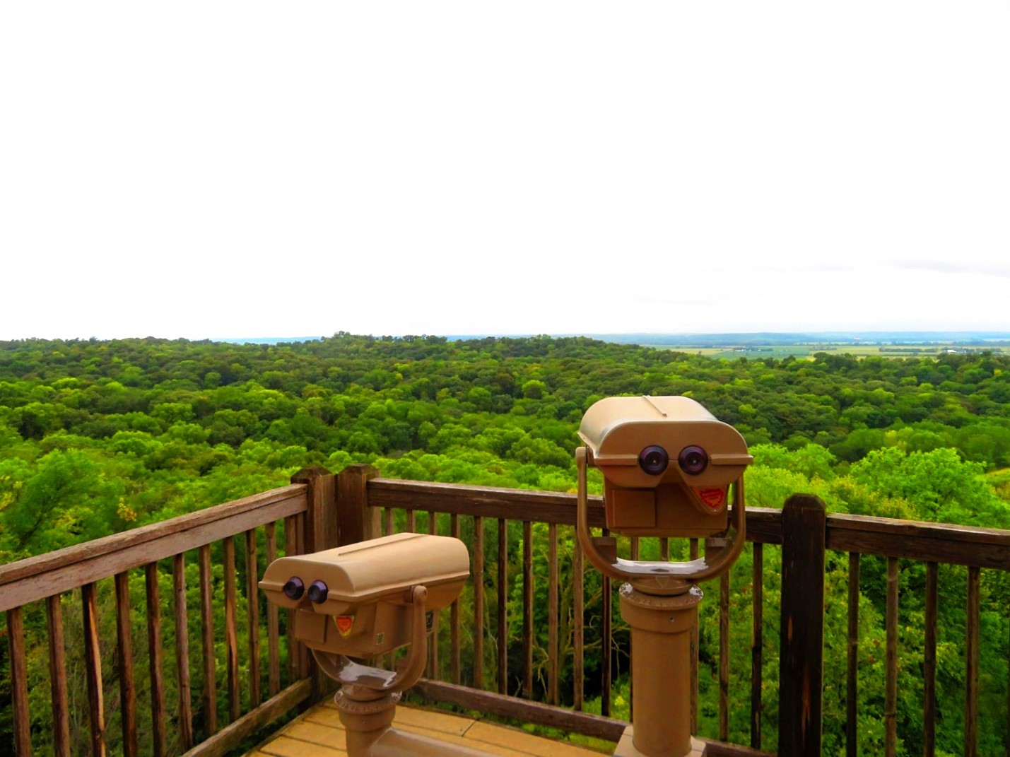
Even though the Lodge and gift shop don’t open til 11am during the week, the Hawk Watch viewing deck is still available anytime. The viewing deck conveniently has view finders if you forgot to bring your binoculars to help spot migrating birds.
The Hawk Watch viewing deck at the Lodge
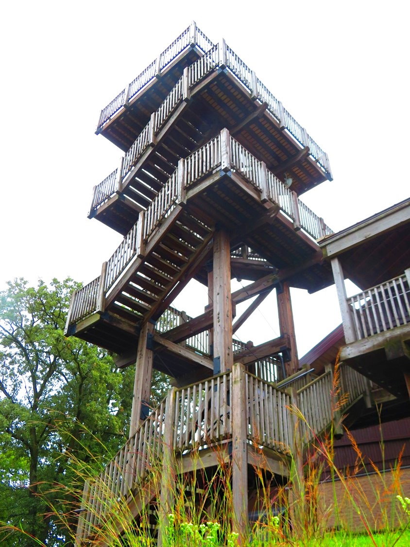
August thru December is a special time when bird watchers come to Hitchcock Nature Center to observe thousands of hawks as well as eagles as they begin their migration south. This part of the Missouri River Valley is known as “hawk highway” due to the wind conditions through the Loess Hills creating the perfect conditions for migrating raptors as they had south. Volunteers monitor the migration from the 45-foot observation tower next to the Nature Center Lodge.
The 45-foot observation tower adjacent to the Lodge provided the highest vantage point and unmatched views of the park
Fantastic views can be found at the top of the observation tower and its absolutely worth the climb! Hawk Watch volunteers and staff likely will be atop watching for raptors and recording info as this is an active scientific project. You are welcome to enjoy the views and engage in conversation as long as the platform doesn’t get too crowded (due to COVID protocol). At 9am, I was the only one on the platform other than the volunteer. He was kind enough to take a photo of me since I was hiking alone today.
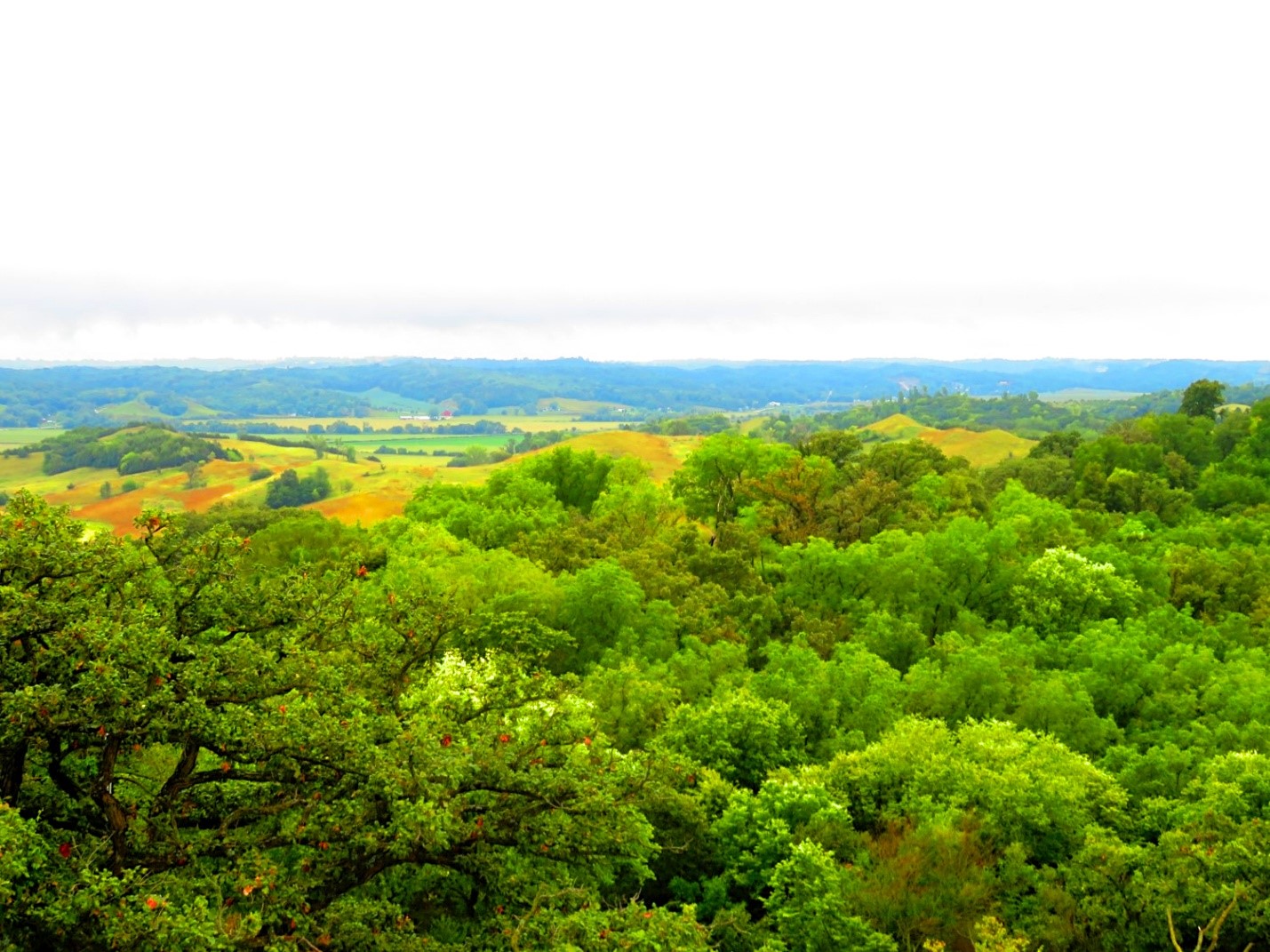
The view from atop the 45-foot observation tower
To start your hiking adventure, I strongly recommend starting at the Badger Ridge Trailhead. You will see a parking lot next to it when you first enter the park. I parked here and walked up to the Nature Center Lodge initially but then returned to start my journey from there. The Badger Ridge Trailhead also has trail maps you can grab to help navigate your way.
The Badger Ridge Trailhead was my gateway to today’s adventure!
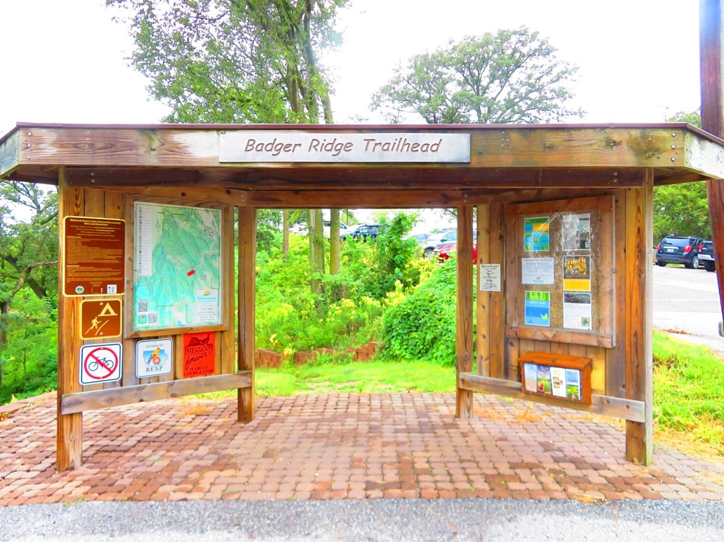
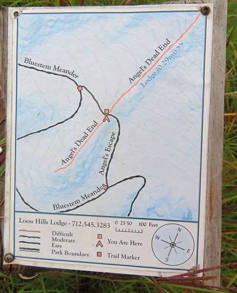
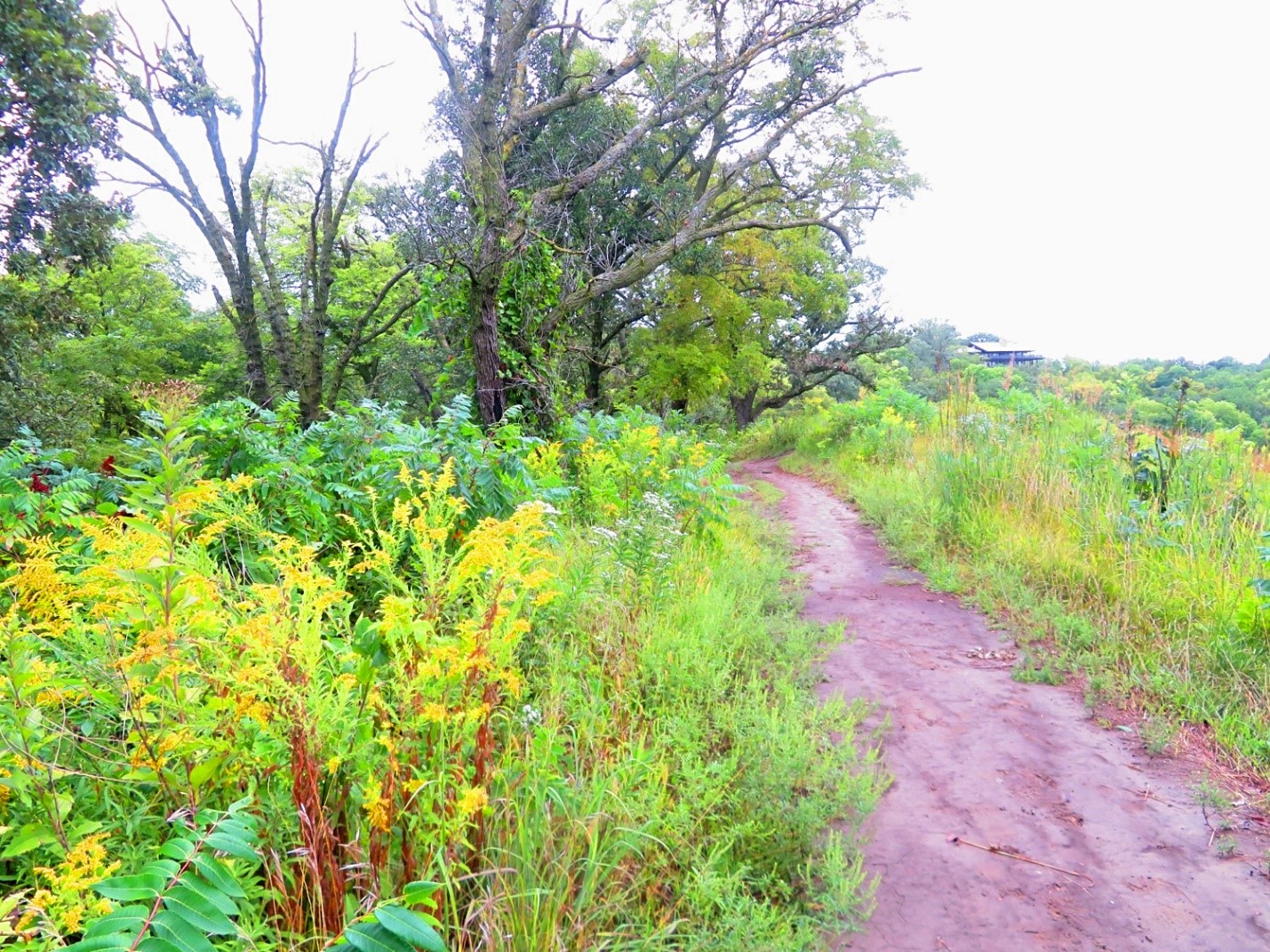
All the trails are very well marked which I appreciated about the park. Anytime a trail merged with another trail, I immediately found a trail marker displayed to show me where I was at. This made it easy to navigate and make choices of where I wanted to go next.
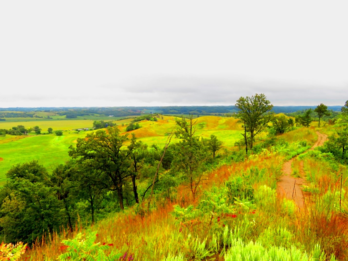
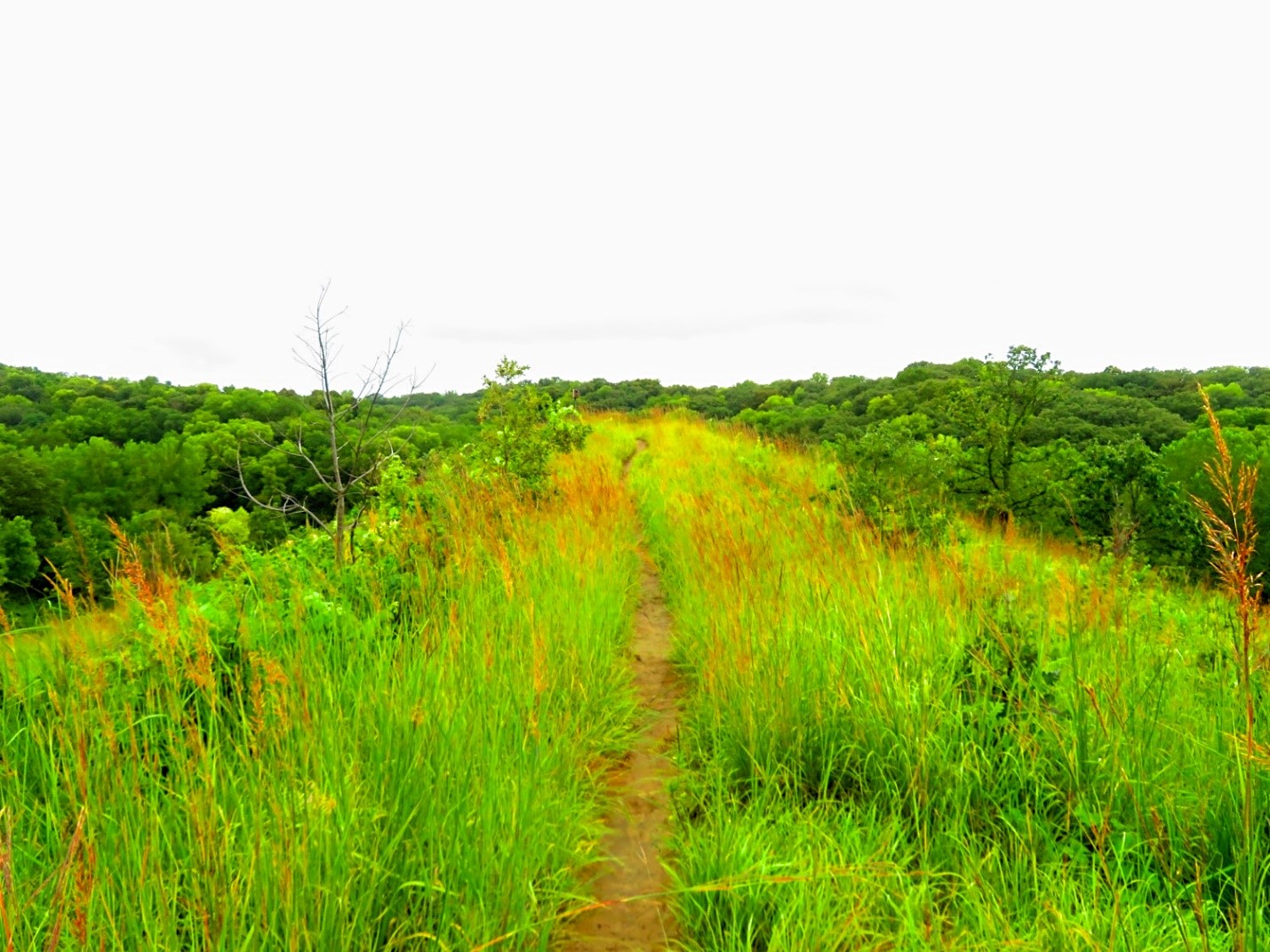
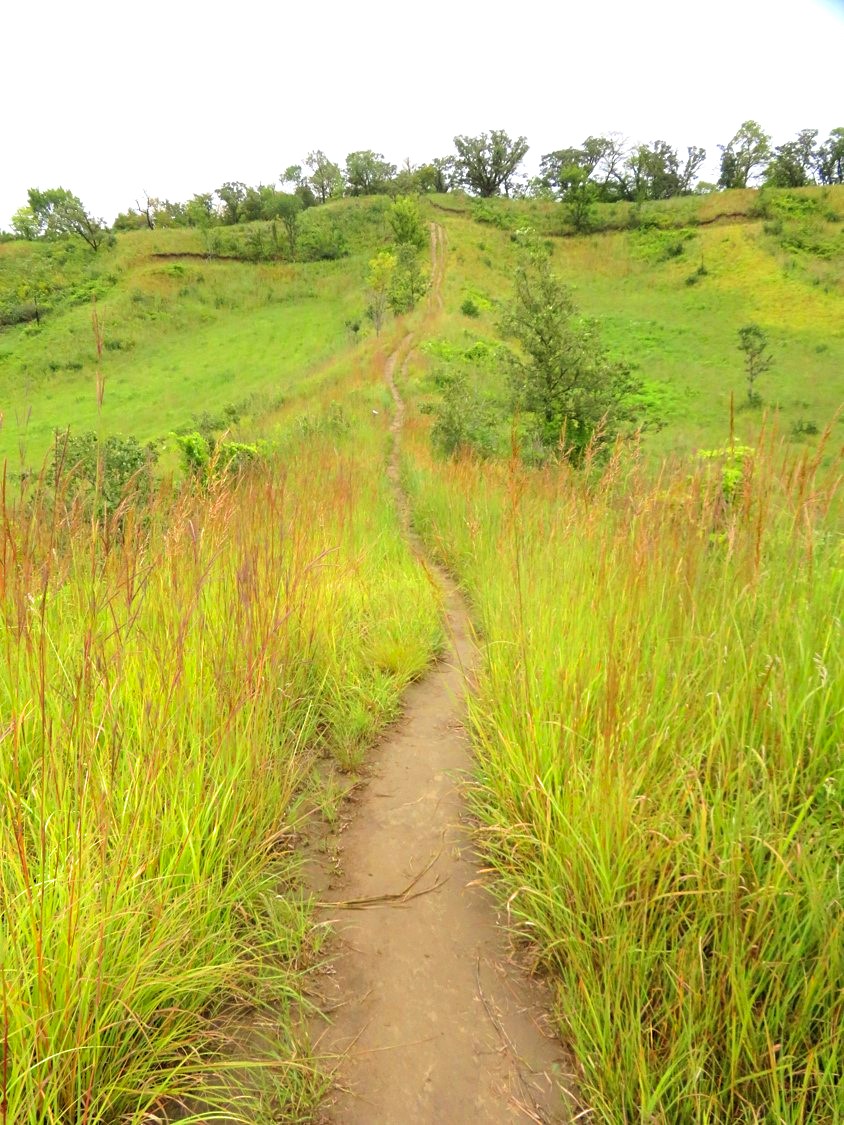
Once I passed thru the trailhead entrance, if you stay to the left fork, you will head down into the valley on Blazing Star trail. At the point you hit the Bouteloua Divide, take the short pass and hike up to hit Badger Ridge trail. Badger Ridge was my favorite trail of the day. Panoramic views of the valley could be seen from all sides. The trail jogged along the ridge line and was sprinkled with wildflowers. It was truly gorgeous.
Blazing Star Trail
Today’s weather was completely overcast and cloudy. Would blue sky and puffy white clouds make for better photos? Possibly so. But I also realized hiking on top of the ridge, I would have gotten a lot of extreme sun. So perhaps the overcast weather was a blessing. It didn’t make the views any less spectacular in my opinion.
Badger Ridge was my favorite trail of the day
Most of the trails are compact dirt. Iowa just received a fair amount of rain overnight so this made for a little mud. However, the trails were still fairly compact even with the rain. You will want to wear sturdy shoes (hiking boots or tennis shoes) but you don’t want to wear brand new shoes. Whatever shoes you wear are likely going to get wet with the morning dew as well as dirt from the dust of the trail when its dry or today they got a little mud on them due to the rain.
I read a few people on Trip Advisor mention needing to wear tall socks. I don’t agree with that. 90% of the trails are well groomed. There were only 2 trails where the prairie grass was longer and I didn’t feel like socks were necessary.
Despite it being September, goldenrod, yellow daisies and lavender were scattered throughout my hike down Badger Ridge and I was disappointed when the trail came to an end.
The difference between Ledges State Park and Hitchcock Nature Center was how well today’s trails were marked. Every time I had a choice to take a different trail, a map/directional guidepost was placed at that point. I got out the paper map I grabbed at the trailhead to see the overall lay of the land and then made a choice of where I wanted to go next.
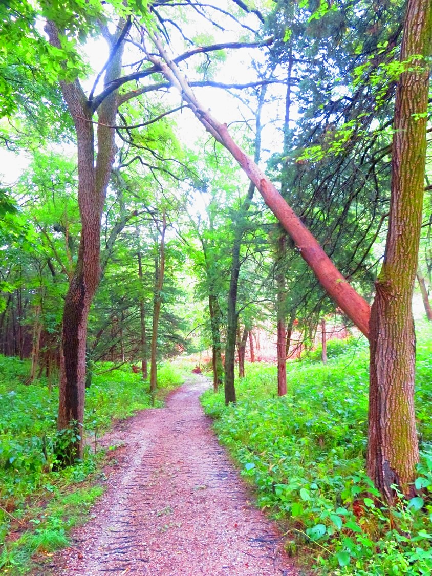
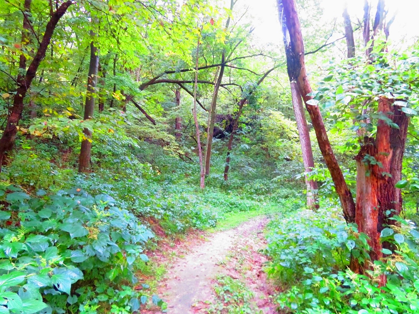
After I hiked Badger Ridge, I chose to go down Hidden Valley trail and this was a unique experience too. Because Badger Ridge was high on top of the ridge, Hidden Valley trail took you down into a deep dark forest of trees. I was intrigued by it as the trail disappeared into obscurity.
Hidden Valley Trail descended into darkness deep into the forest
Errant spider webs would sometimes run across the trail. Not to worry, these weren’t massive spider webs; more like a few strands of webbing. But after I walked thru a few, I trained myself to look for them. This told me not many people are on these trails. The park is not crowded at all and I was happy to have it mostly to myself.
Hidden Valley appeared dark and secluded as I descended into its depths. I suddenly felt like I was walking through a giant aviary. Despite the darkness the canopy of trees provided, there were so many birds chattering back and forth while woodpeckers tapped incessantly. Hidden Valley had its own special charm and I’m glad I took the trail down.
Hidden Valley wasn’t completely dark – an occasional break in the trees allowed intermittent light in
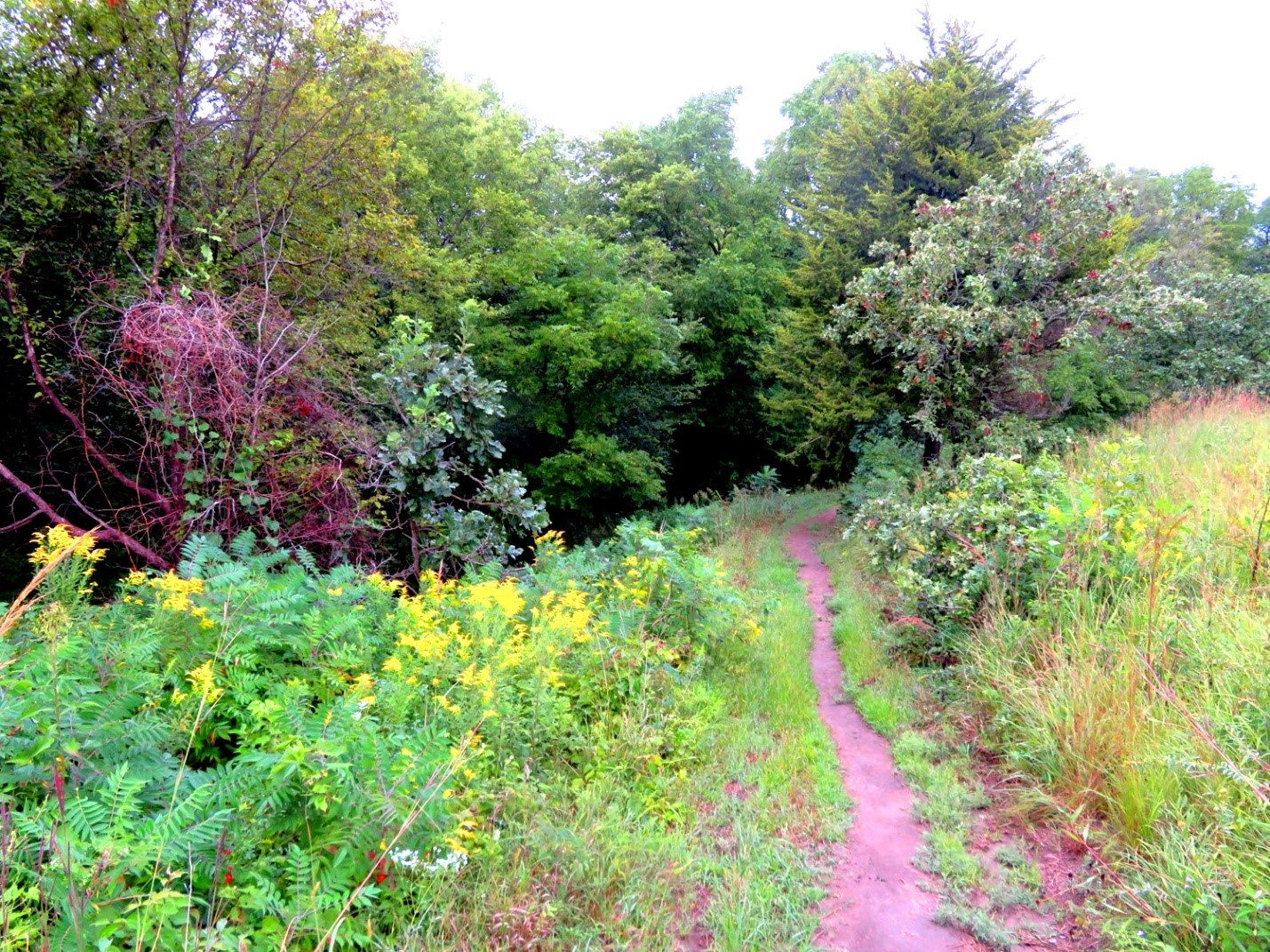
From there, I hiked Heritage trail over to Bluestem Meander. Bluestem Meander is a gentle sloping trail with taller prairie grass that allowed me a transitional passage to the next challenging trail. Here is an example where the trail is not well groomed but the longer grass allowed me to clean any of the mud or dirt off my shoes. Because it was still early morning, the grass was very wet with dew. It did a great job of cleaning them up!
What goes down, must eventually go back up. I had descended down into Hidden Valley and now these transitional trails started bringing me back up again. Angel’s Escape was a short but very steep climb that took me up to Angel’s Dead End.
Excellent maps/guideposts helped me navigate my path. I hiked up Angel’s Escape (Moderate Difficulty) to Angel’s Dead End (Difficult)
Angel’s Dead End is just what its name says. It’s a trail that runs to a dead end, look-out point. You know you are close to the end because there is a bird nesting pole/house just before you hit the trail’s end. And then you are left with a view of the valley below as the trail abruptly ends. This is the first time I saw anyone else on the trails all morning as another family hiked out to the end of the point behind me.
Walking out to the end of the line on Angel’s Dead End
Angel’s Dead End is listed in red on the map. The trail map is color coded; red means most difficult. I can definitely see why. There is an incredibly steep climb to get back to the trail system in the middle of the park. I didn’t want to go back the way I had come; I wanted to see new scenery. As a result, there was only way to go: UP! This is the part of the hike where I put away my pen and paper. I put away my camera. Because I needed both hands to guide myself up this almost vertical ascent. Wowza!
I hiked back to the start of Angel’s Dead End to get back to the main trail system in the middle of the park and what a climb that was! This pic doesn’t do it justice!
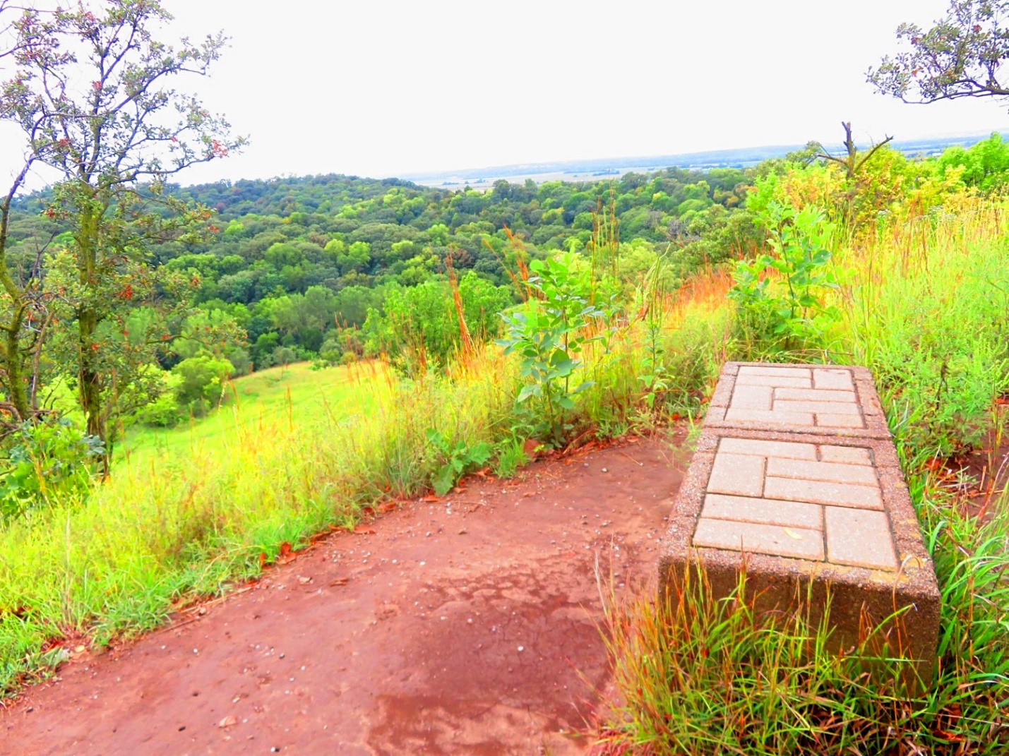
Thank goodness at the top of Angel’s Dead End is a bench so I could take a long breather before continuing on. I’m actually glad I climbed up though. I couldn’t imagine having to go down it if I was coming from the opposite way. It was so steep; I would be afraid of losing my footing coming down.
A bench at the top of Angel’s Dead End allowed me a much needed break
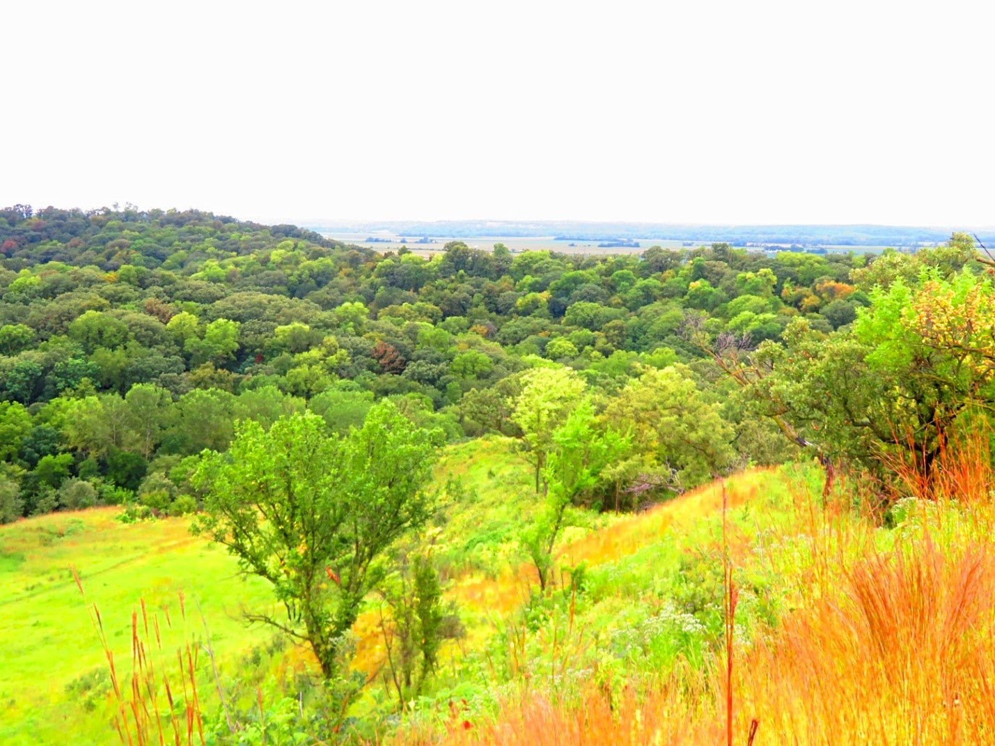
Sitting back on top of the ridge while I rested on the bench, I was rewarded with another majestic view. The lodge is only .29 miles away as I hiked back on Fox Ridge Run trail.
The view from atop Angel’s Dead End
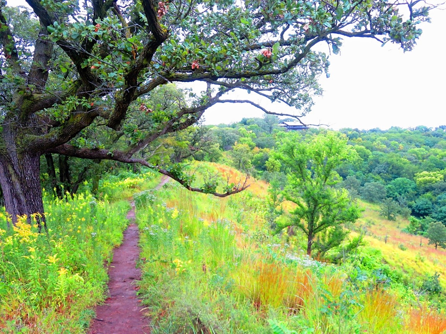
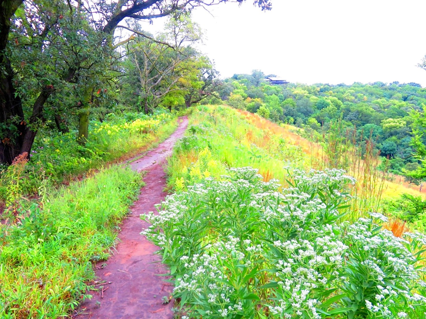
Fox Ridge Run provided exquisite views of the Missouri River Valley while colorful wildflowers peppered the trail as I made my way back to the lodge. Beautiful oaks provided cover along the ridge line as well on this relatively easy, flat trail.
Fox Ridge Run was absolutely gorgeous with its Oak trees and wildflowers!
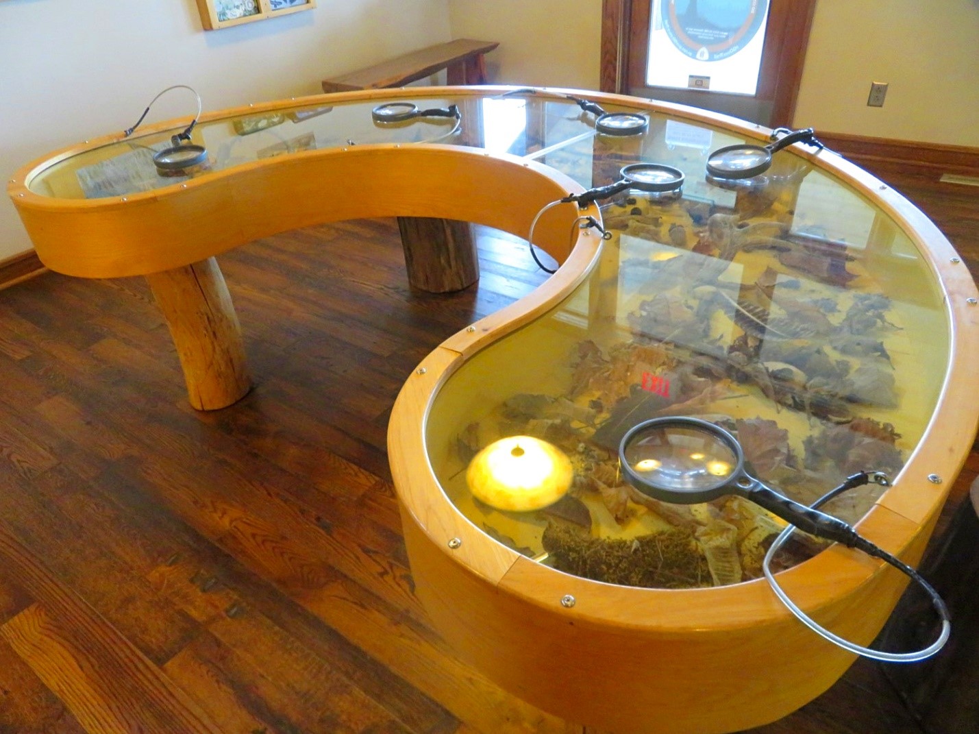
The Lodge opens at 11am and I stopped in to grab additional brochures about the park along with tourist info about the surrounding area. Contained within the Lodge is the gift shop as well as nature exhibits.
A gift shop will provide a souvenir or t-shirt if you’d like to take a memento home with you. Informational videos can be watched in a viewing area that provide details about the park history and ecological restoration. The Lodge also has a great interactive exhibit for kids.
An interactive exhibit for the kids inside the Lodge
I only hiked half the park today. I’d like to return to hike the other half. Each trail is different and provides distinct views worth exploring. You could easily make a day of it by hiking all the trails!
I had just as many photo ops here as I did at Ledges State Park; maybe more. Because up here I was following the ridge line and panoramic views were all around me. At Ledges State Park, you were down in the sandstone cliffs and didn’t get the same vantage point of the horizon with all the surrounding trees.
Fox Ridge Run
The Loess Hills are truly magical landmarks. I can’t believe I didn’t know about them! Go in the summer when all the flowers are blooming and the lush trees provide a green canopy. Or consider going back in the Fall when the leaves turn and the tree lines explode with color.
Hitchcock Nature Center is just a small part of the 200 miles containing the Loess Hills. High on my list to visit next is Preparation Canyon State Park which also comes strongly recommended. I may try to do that in a month or so once the leaves start to change.
It was so fun exploring what I could before it was time to head to lunch. Hitchcock Nature Center is pretty much out in the middle of nowhere and not a lot of lunch options are available.
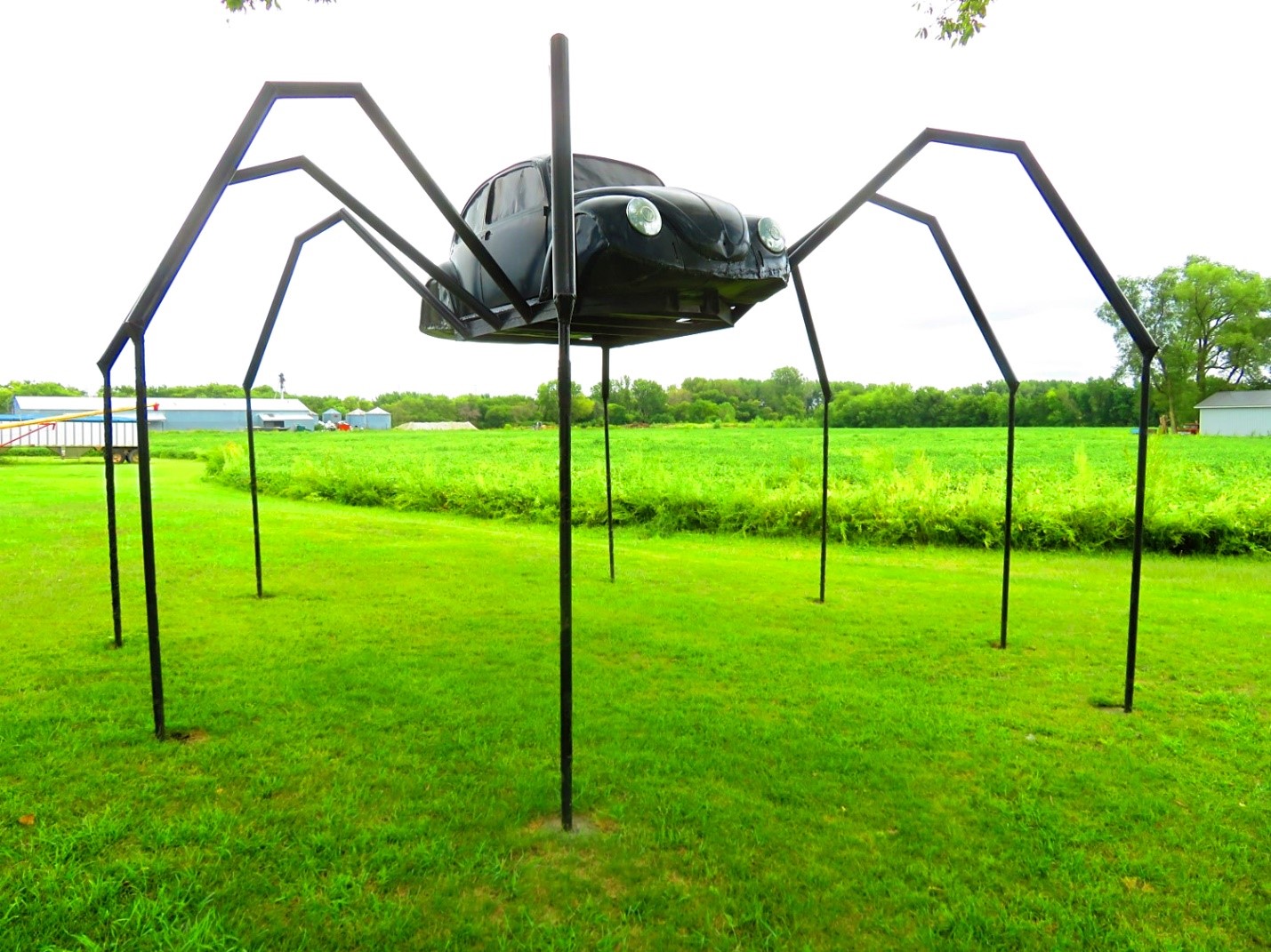
I decided to stop at Avoca on the way home which is right off the interstate for my late lunch. Avoca also has one of those quirky roadside attractions I wanted to see: a spider made out of a Volkswagen Beetle. This isn’t something I would drive all the way out west to see. But while I am in the area, it’s a fun novelty attraction that will bring you a smile and a good photo op. (For directions, scroll to the end of the blog)
The quirky roadside attraction in Avoca: Volkswagen Beetle Spider
After a few pictures of the spider, I jumped back on N Walnut St to head back toward the interstate. Just before you get to the interstate, you will see Grandma’s Diner. You probably noticed it as you passed as it’s only a few minutes once you take the exit. Avoca has several options for food but how can you go wrong with a restaurant that has Grandma in its name?
Grandma’s Diner is nothing fancy. It’s an old-fashioned country diner. This is a small local diner in small town America. But the idea of a home cooked meal appealed to me more than Taco John’s up the road.
Lunch at Grandma’s Diner

The burgers here are made with fresh beef and are hand pressed. The chicken I’m told is the best in the county. The diner has been here for over 20 years run by a husband and wife team. The husband is the waiter; the wife is the cook. So please understand when it’s busy, service can be slow as it’s just the two of them managing the restaurant.
As my new passion in the pandemic is cooking, I have an appreciation for the time and effort it takes to cook, let alone if you only have a 2-person operation running the whole show. The food is worth the wait!

The diner has a loyal customer following with the locals who eat here every day. That says speaks volumes. You may choose from a whiteboard full of specials or order off their extensive menu. My burger was juicy and the onion rings were gigantic. YUM!
The restaurant isn’t spacious by any means so you may want to consider getting your food to go. Bring cash. This country diner doesn’t take debit or credit cards.
As I devoured my food I reflected on my day. Today’s park is truly a hidden gem and not many people were here today. Being on top of the Loess Hills with the amazing views and profound stillness. How could anyone be in such a place and not feel God up here? It was almost spiritual. Whatever noise you have going on in your life, I guarantee a few hours out here on the trails, it all melts away.
Me standing on top of the 45-foot observation platform

Hitchcock Nature Center – Addt’l Park Info/Amenities
Link to Hitchcock Nature Center
Enjoy a wide range of activities that go beyond just hiking, such as picnicking, camping, bird watching, sledding, snowshoe hikes, night hikes, star gazing or just enjoying nature. The park is constantly hosting annual events such as monarch tagging, eagle migration, Night Sky, Holly Jolly Night Hike, and Owl Prowl.
Dogs are allowed on the trails but must be leashed.
Overnight facilities feature camping cabins and 18 RV sites with electric service. Plenty of scenic backpack campsites are located deep in the back country of the preserve. Tent sites with picnic tables and fire rings are also available within proximity to water, a shower house and restrooms.
Camping cabins include heat and A/C, beds, electricity, refrigerator, picnic tables, microwave, campfire ring, grill and outside water hydrant. Restrooms and a modern shower house are nearby. All you need to bring is bedding, pillows, cooking/dining supplies, charcoal, and coffee maker. To reserve visit: www.pottconservation.com (712-328-5833)
Directions
Normally I don’t post directions but Google Maps was a little tricky so I’m including them for this blog.
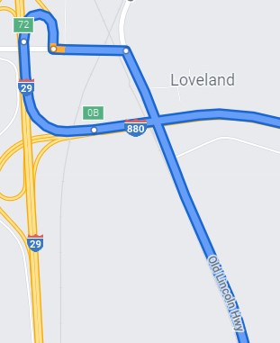
Directions to Hitchcock Nature Center: Take I-80 west to I880-West. Take I-29N but as soon as you get on I-29N immediately take Exit 72 (Loveland). As it wraps around, you will come to the stop sign (T intersection). Take a left onto DeSoto Ave (you will see a DeSoto Mini Mart here). You will go through the tunnel, over the railroad tracks and come to another T intersection. Here you see the Old Lincoln Highway. Take a right (go South). You will see the signs for Hitchcock Nature Center. It was a 1 hour 43 min drive from West Des Moines.
Directions to Avoca/Volkswagen Beetle Spider: Take the Avoca exit off I-80. Go south on Highway 59 (which essentially becomes N Walnut Street – the main street through town). The Volkswagen Beetle Spider will be on your left hand side just off W Washington Street. It’s easily seen from the main road.
Things to Bring:
- Hiking Boots or Tennis Shoes – A good sturdy pair of shoes is necessary for the hikes. Tevas or sandals will not provide adequate support.
- A spare set of shoes for after your hike – Your shoes will likely get dirty/muddy or even wet (depending on if you do a morning hike) Your feet will thank you for a clean/dry pair of shoes when you are done.
- Bug Spray – There are bugs especially on the shadier parts of the trail or down in the forest area.
- Sunscreen – I hiked on a cloudy day but you will certainly get a lot of sun high upon the ridge.
- Cooler full of drinks/snacks – The closest convenience store is just off Exit 72 on DeSoto Ave (the DeSoto Mini Mart). You will work up a thirst and an appetite trekking even for a few hours.
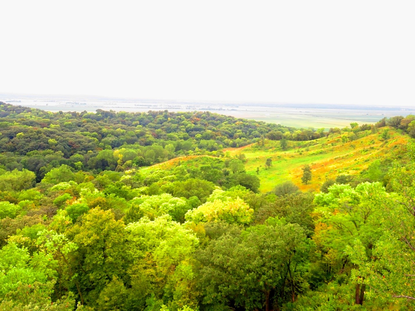
A view of the Missouri River Valley – the far right side of this pic is Fox Ridge Run trail that I hiked today